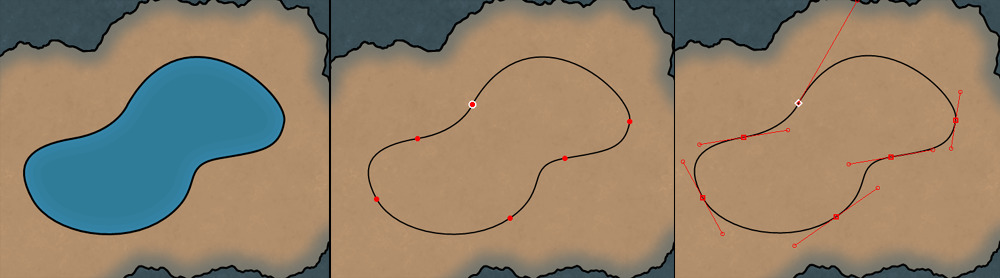
Other World Mapper supports multiple pen types for drawing the outline (or core path) of map items that can be freely combined: lines, Bézier curves, fractal segments and Bézier Fractal segments, freehand pen and shape pens.
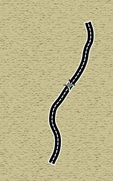
The Bézier fractal pen allows creation of fractal shapes riding on connecting Bézier curves. This allows you create fractal shapes that continue smoothly from segment to segment. The free hand pen is very useful to quickly create island groups or hand drawn rivers or roads.
Random segments can be regenerated real-time with hotkey.
Other World Mapper's 2D engine allows editing a shape from control points and also full path editing, including Bezier curves by their center and control points
Other World Mapper supports vector path operations to create more custom shapes. Items can be combined using union, intersection and difference operations. It's important to note that Other World Mapper keeps the original nature of sections that make it to the new item path, so for instance Bezier curves that are part of the combined path remain as Bezier curves (they are not turned into line segments).
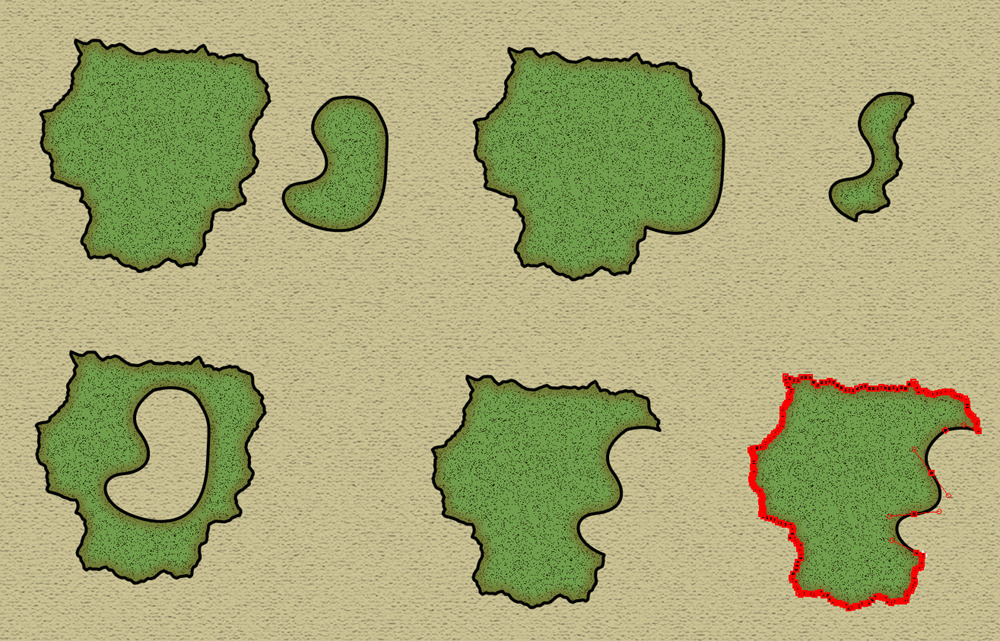
Closed items (landmasses, regions, etc) have modes so that in addition to creating a new item you can add or subtract from an existing one with the item tool. Functionally, this is very similar to our path Boolean operations support, but from a UI point of view it makes it faster and more intuitive to add or remove parts of an existing item's shape.
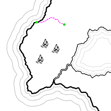
Rivers, roads, walls and other open path map items can have multiple branches. Branches are connected with what we call nexus points so that the junction between branches can be moved together. New branches can be added to existing items and existing branches can be deleted without having to delete the entire item.
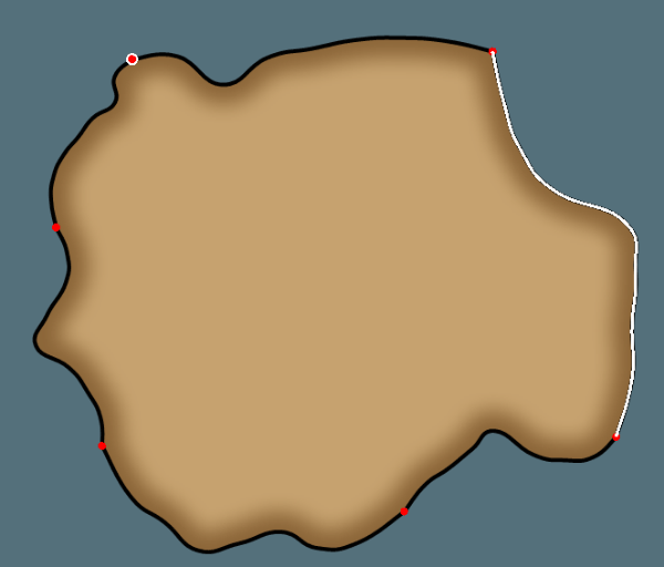
Other World Mapper allows generation of random fractal segments with fully configurable parameters and automatic modes. Segments can be "scrolled" through until finding the desired segments.

Fractal segments can also be regenerated for finished items, using the Edit Shape Tool.

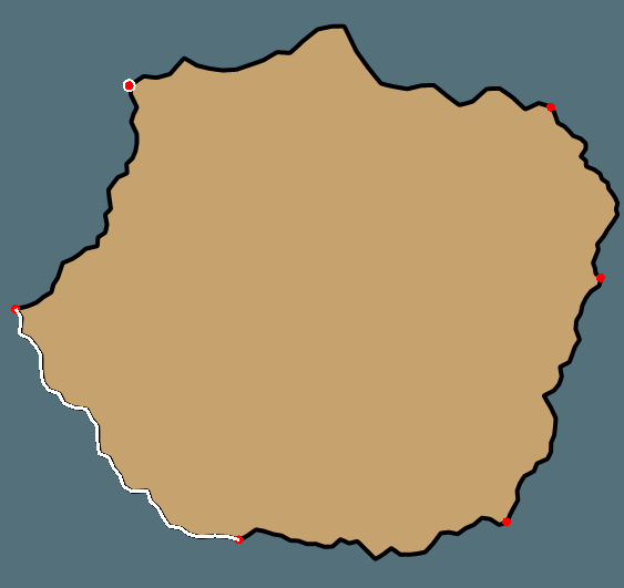
Another part to this feature is to further fractalize an existing segment, not regenerating an entire segment, but creating fractal points between existing points. This feature can be particularly useful when creating a more detailed map of an area from an existing region of a map.
Many tools, such as region, boundary, road and rivers, can follow existing elements. For instance, this feature can be used to have a political boundary that follows a river or road, or a region that is bounded by a body of water.
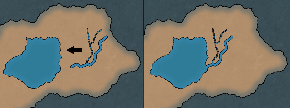
Automatic integration between rivers and bodies of water, so that rivers "merge visually" into lakes, but remain as separate layers.
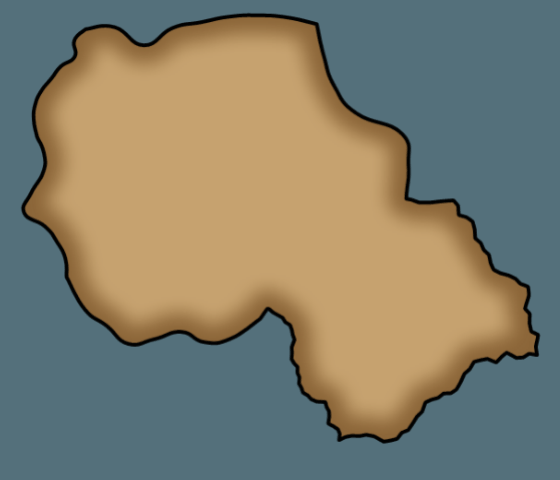
Automatic generation of shorelines for landmasses, lakes, and rivers. Shorelines have different style options, such as spread and color, and can be changed, enabled or disabled, at any time.
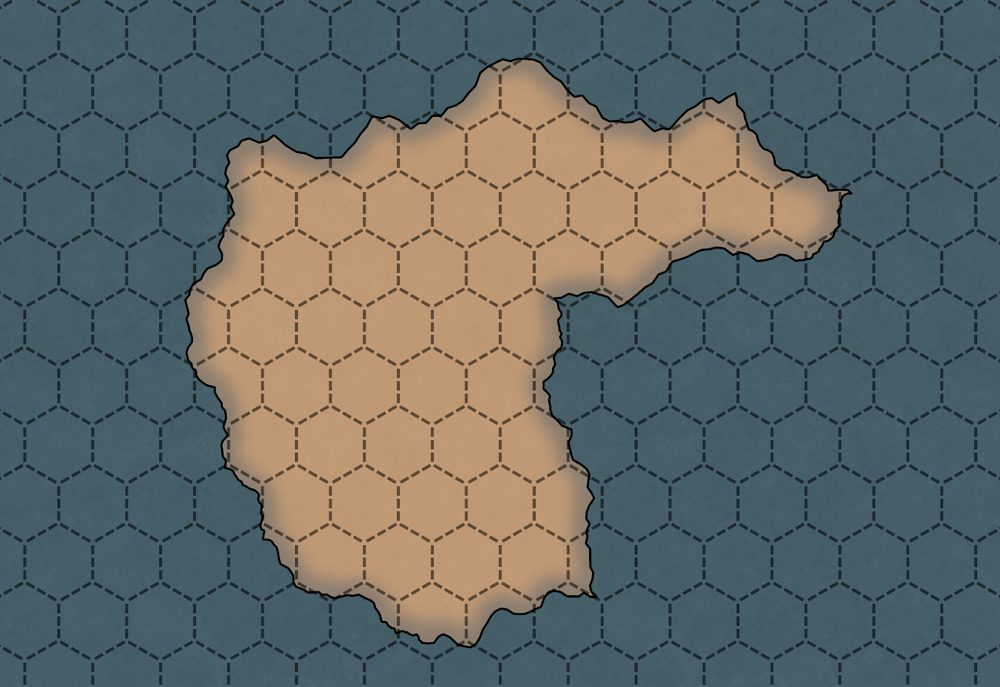
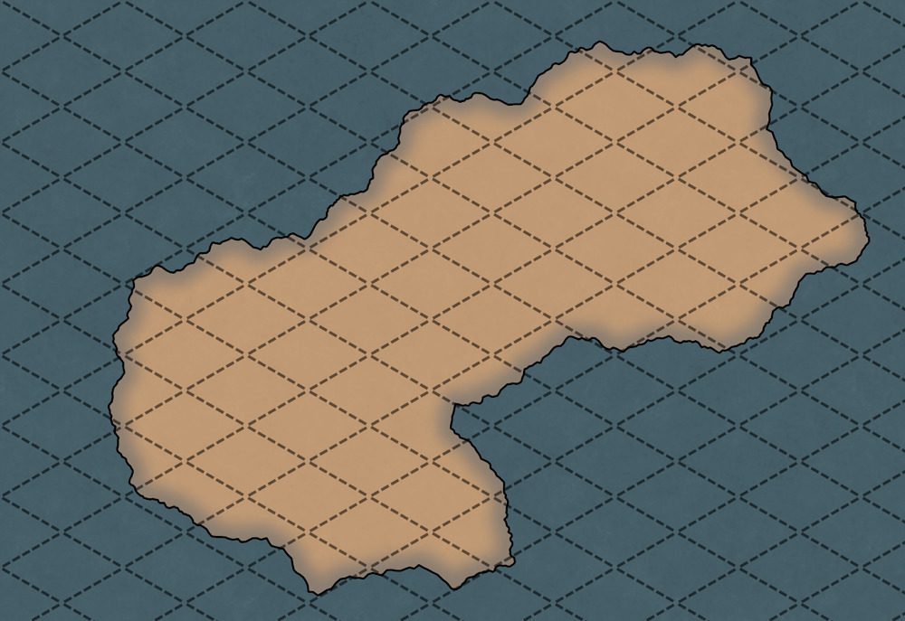
Support for multiple types of grids as well as snap to grid functionality.
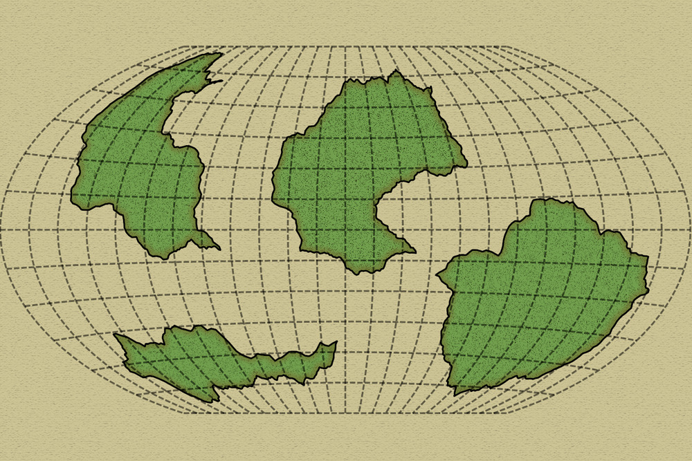
For those making world maps, or sections of world maps, Other World Mapper has the capability to show projection overlays. We're including several projections with the first release: Equirectangular, Mercator Spherical, Transverse Mercator, Robinson, Winkel Tripel and Azimuthal Equidistant. We are also open to adding other projections if requested by our users!
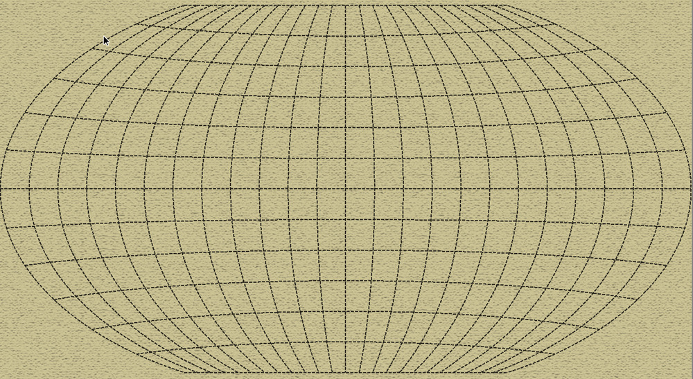
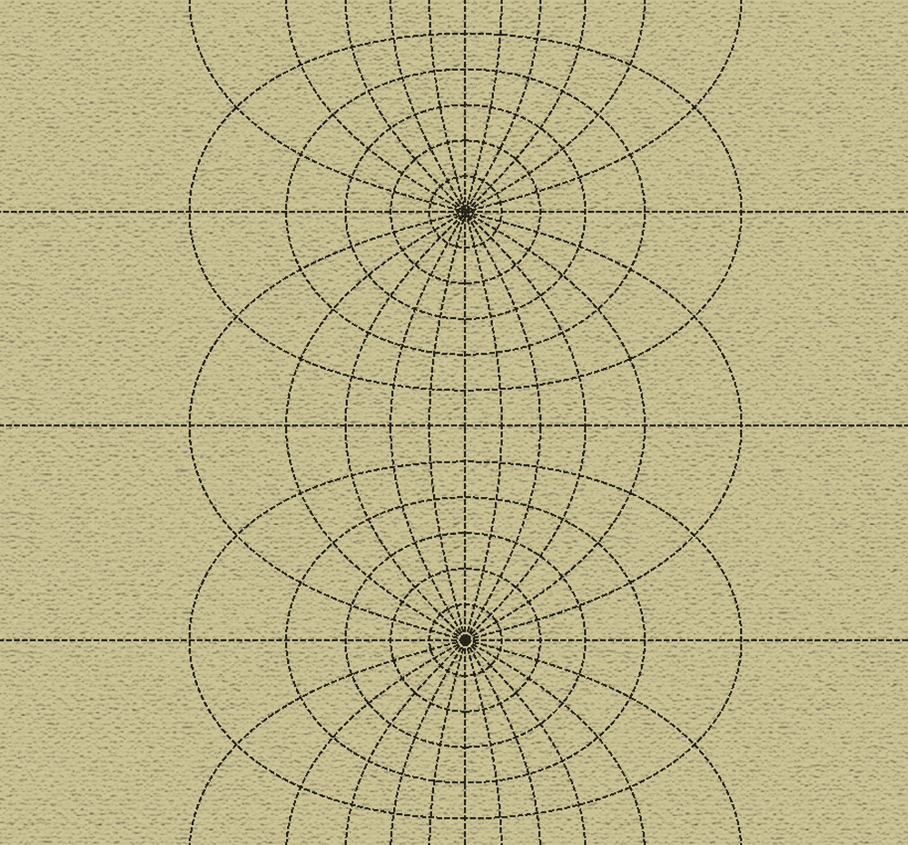
Projection overlays don't have to cover the entire map. If you are mapping only a section of your world but want to keep realistic parallel and meridians for your choice projection, you can define your map covering a specific lat/lon range.
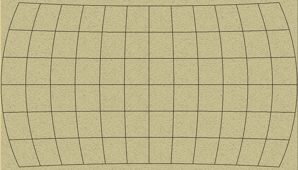
Another useful feature of Other World Mapper is Projection Transformations. It pertains most to fantasy cartographers and has been a source of much discussion during our Kickstater campaign. If for instance you create your map in an equirectangular projection, such as the map below:
Other World Mapper will let you transform your map to the other projections we support, for instance Winkel Tripel, Robison or Spherical Mercator.